top of page


OAS and LPV
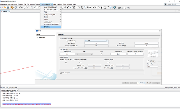


CAT II
ILS Cat II: ILS Cat II OAS and those portions of ILS Cat I which lie above the limits of ILS Cat II; OAS CATII up to 150 M above threshold AND CAT I from 150 M to 300 M
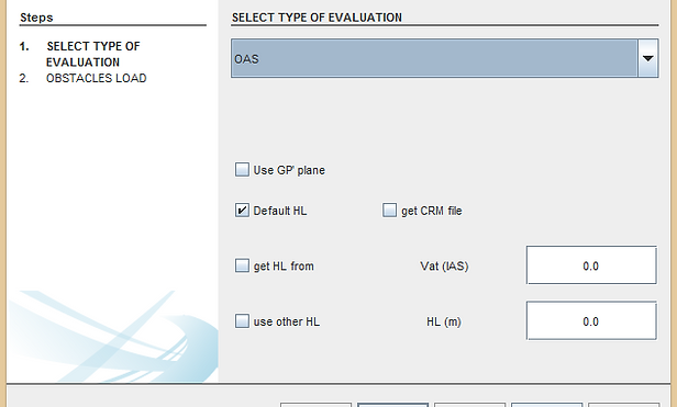
HL adjust and GP prima plane
a) for airfield elevation higher than 900 m (2 953 ft)
b) for glide path angles greater than 3.2° upt to 3.5°.
c) User can edit HL with a IAS VAT or a choose one.
c) User can select method to considerer obstacles on MA or Approach
ILS: Glide path angles above 3.5°
a) the W surface of the OAS;
b) origin of the Z surface of the OAS; and
c) height loss/altimeter margin
Slope MissAproach
5.0% is the limit as in the tables is not indicated more.
VIDEO 3 OAS and SBAS
bottom of page